

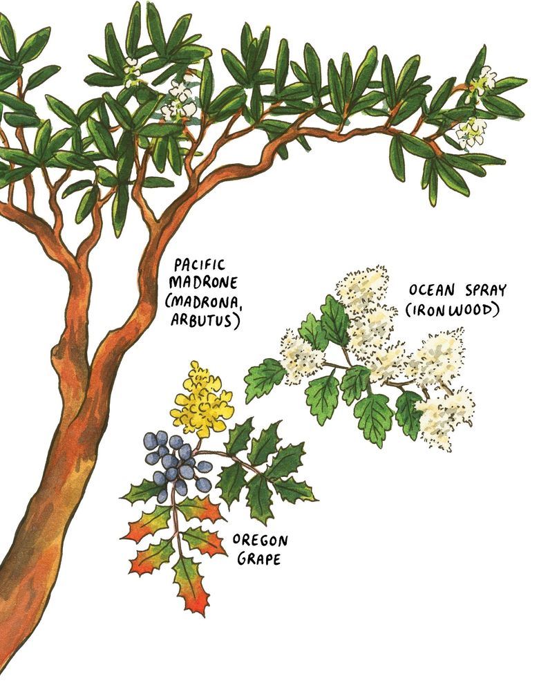
Editor’s note: The following is an edited excerpt from “On Island Time: A Traveler’s Atlas,” a new book by Chandler O’Leary, published by Sasquatch Books. The book, whose subtitle is “Illustrated Adventures on & Around the Islands of Washington & British Columbia,” goes on sale Feb. 28.
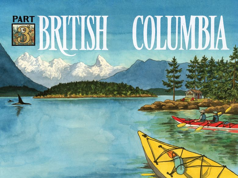
THE GULF ISLANDS occupy much of the northern Salish Sea and are some of the most popular (and sunny) vacation spots on the Canadian west coast. There are too many islands to fit into one trip, so think of this chapter as a tasting menu to help you sample the region.
When defining the archipelago, it depends on whom you ask. The term “Gulf Islands” is often used as shorthand to refer only to the Southern Gulf Islands, the Canadian half of the archipelago that includes the San Juan Islands of Washington. The more northerly islands are more loosely defined — some call them the Northern Gulf Islands, and others simply lump them in with other provincial districts. For simplicity’s sake, this chapter deals with all the major islands occupying the Strait of Georgia (once called the Gulf of Georgia, hence the name). Listed first are the Southern Gulf Islands, and we’ll move northward from there.
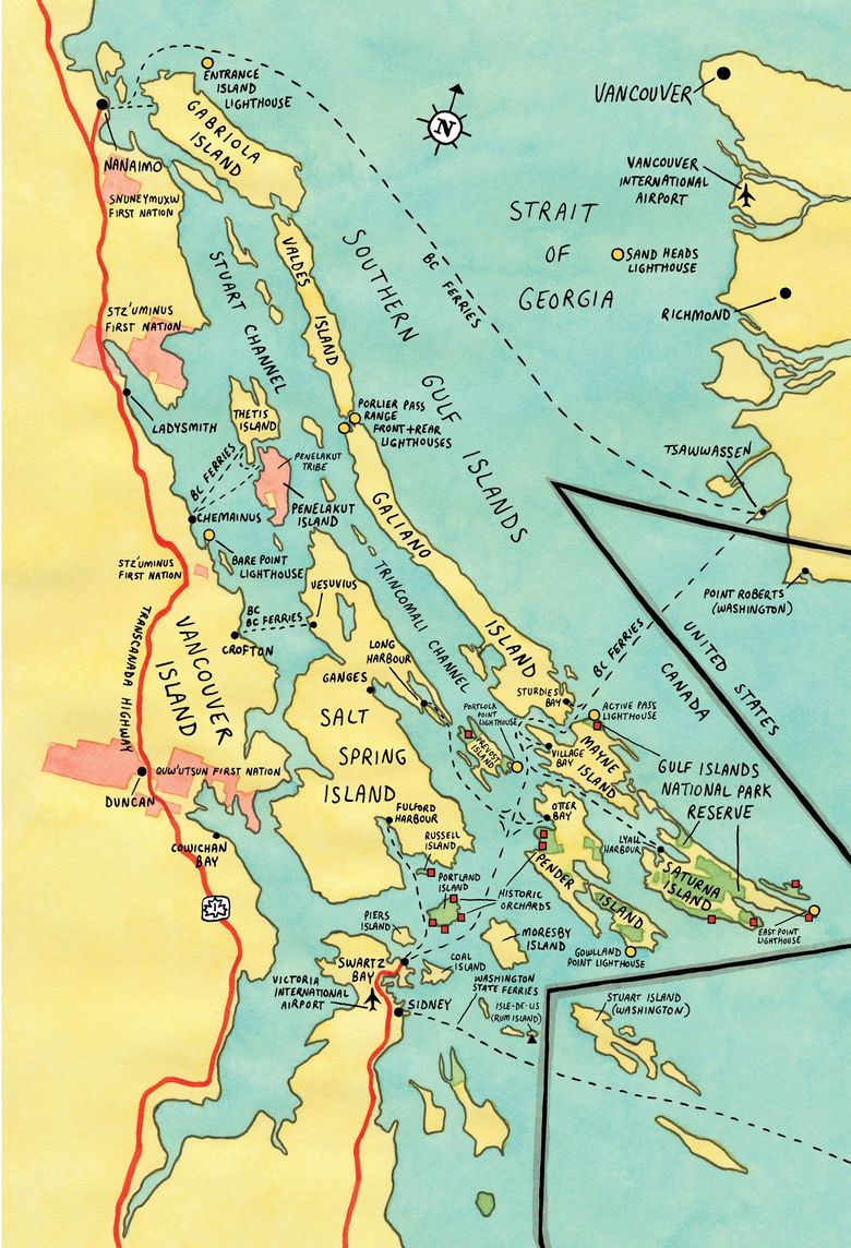
For the most part, the major Gulf Islands are accessible by BC Ferries from Vancouver or Tsawwassen on the mainland, or from various points along the east coast of Vancouver Island. A few islands require an interisland ferry or a transfer on Vancouver Island and, currently, the ferry to Texada departs only from the Sunshine Coast.
Hopping around to multiple islands takes planning to navigate multiple ferries. (Pro tip: You can get discounted fares by paying with a preloaded BC Ferries Experience Card.) Only Salt Spring has public bus transit — for the most part, in the Gulf Islands, you are on your own for ground transportation.
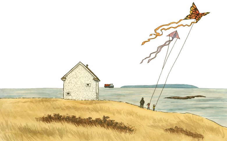
Salt Spring
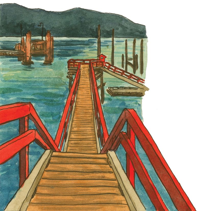
Starting at the archipelago’s largest, most touristy island, or using it as a base camp for island hopping, is a logical choice. You’ll find diverse lodging options here — resorts, inns, vacation rentals, even yurts — as well as three ferry terminals: Fulford Harbour for the Swartz Bay crossing, Vesuvius for the Crofton ferry, and Long Harbour for Tsawwassen and Swartz Bay, as well as the interisland boat to Galiano, Mayne, Pender and Saturna islands.
Salt Spring is an ancestral land of several Coast Salish peoples, and thus has been known by different names — including Klaathem, the Cowichan word for “salt” — for millennia. You can find an ancient petroglyph of a harbor seal’s face at Drummond Park, across from the ferry landing in Fulford.
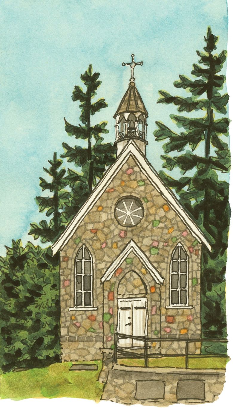
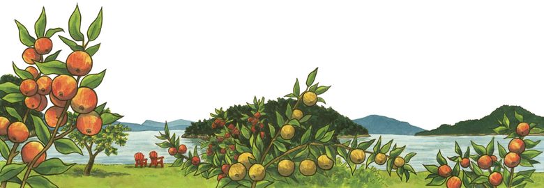
In the 1850s, the British government opened the island for preemption — in which settlers could occupy and improve land before purchasing it. Many of these early settlers were Kanakas — Native Hawaiians who previously had worked for Hudson’s Bay Company. (In fact, the trade language called Chinook jargon spoken by many of HBC’s international workers was mainly comprised of Indigenous, French and Hawaiian words.) The Hawaiian community built Saint Paul’s Church in Fulford and established heritage fruit orchards on Salt Spring, Russell and Portland islands.
Black pioneers were also central to Salt Spring’s history. In 1858, colonial Gov. Sir James Douglas invited Black people in California — who were freed from slavery but could not legally vote or homestead — to take up land claims in B.C. About 600 settlers sailed north (you can find paving bricks commemorating many of them in Bastion Square in Victoria), and about a dozen preempted homesteads on Salt Spring. The island’s first teacher, John Craven Jones, was one, and a few descendants of other early Black pioneers remain on Salt Spring today.
By the early 1900s, there were also Japanese communities on Salt Spring and Mayne islands. But like their American counterparts, Japanese Canadians were forcibly incarcerated during World War II, and their property was seized and sold off by the government. You can discover more about the island’s immigrant history at the Salt Spring Museum, near Ganges.
In the 19th century, health retreats became a hybrid of vacations and health care. Travelers flocked to resorts built over natural mineral or hot springs to “take the cure.” Salt Spring’s namesake mineral springs, long known by Indigenous peoples, are now owned by Mineral Springs Resort. The springs have inspired Salt Spring’s islandwide emphasis on wellness — many tourists come for spa treatments, meditation retreats or even paddleboard yoga classes.
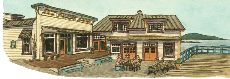
The local food scene is also serious business here. Dining options abound in Ganges. For a dash of Salt Spring culture, try the Studio Tour circuit (look for the blue and white sheep signs around the island), or take a summer-evening stroll at Duthie Gallery’s outdoor sculpture garden. Salt Spring Pride Festival, held each September, is one of Canada’s largest LGBTQ+ events. Consider shopping with local Salt Spring Dollars, which are exchanged on par with Canadian currency. Look for the $$ symbol at businesses that accept them.
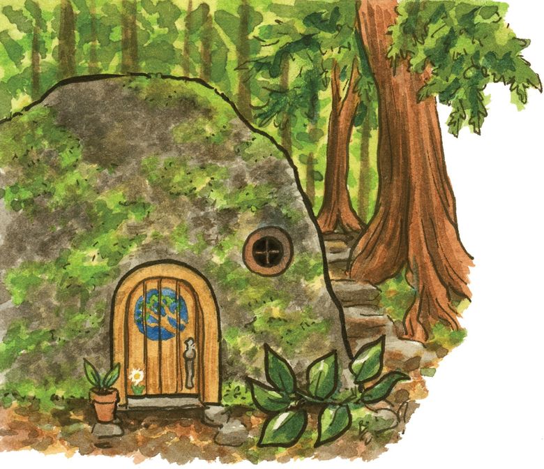
Though Salt Spring is as mountainous as Orcas Island, it’s also a favorite of cyclists. Bike rentals (including e-bikes, which help with the steep hills!) are available at several locations in Ganges. Boaters will find full-service marinas and kayak rentals at Ganges and Fulford Harbours. Ruckle Provincial Park, which preserves the island’s oldest working farm, is a favorite paddling spot. More seasoned kayakers might want to set out on the Gulf Islands Marine Trail (similar to the Cascadia Marine Trail). Or take a sea kayak tour from Ganges out to Third Sister Island, where you’ll see a large Indigenous shell midden at Chocolate Beach. There’s also a marine campsite at Musgrave Point for kayakers. Hikers will love Mount Maxwell Provincial Park (warning: feral sheep!) and Burgoyne Bay Provincial Park. And though the view at the summit is its own reward, the trails at Mount Erskine Provincial Park have a little extra enchantment. Look for a series of handmade fairy doors hidden in plain sight along the forest trail.
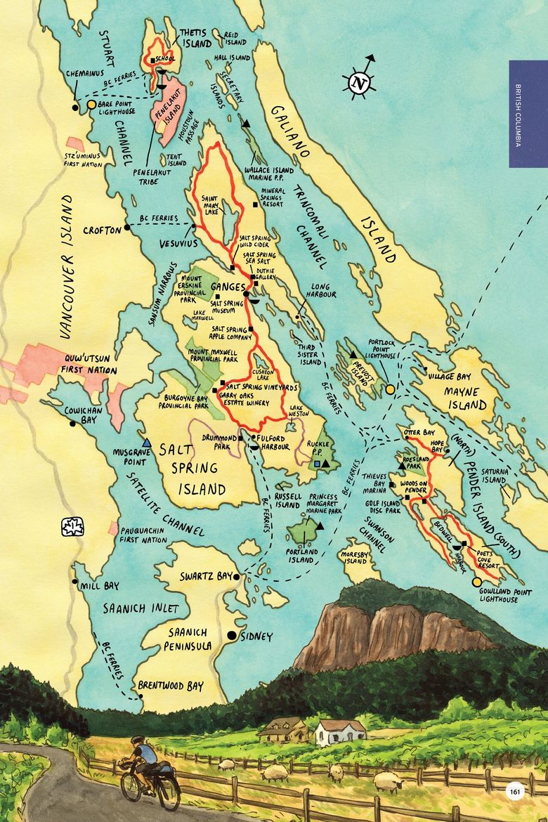
Pender
The next island east of Salt Spring, thanks to a steamship canal cut through in 1903, is actually two islands — locals call it the singular Pender or the Penders. BC Ferries offers service from Tsawwassen and Swartz Bay, as well as an interisland ferry that makes the rounds between Salt Spring, Galiano, Mayne and Saturna islands. Floatplane service operates out of Bedwell Harbour, and you can reach South Pender overland via a one-lane bridge built in 1955.
Kayakers love Pender, and with 33 well-marked public beach access points, you can take your pick of put-ins. North Pender is the more populous island, though it has no incorporated town center. A large suburban subdivision built here in the 1970s (inspiring the formation of the anti-development Islands Trust group) is now home to a well-known disc golf course, Golf Island Disc Park. Nearby Roesland — protected by Gulf Islands National Park Reserve — is a former 1920s resort that now houses the seasonal Pender Islands Museum. The breakwater at Thieves Bay Marina is an excellent spot to watch southern resident orcas as they pass by close to the shore along the Whale Trail.
If you arrived without your own vehicle, you might have use for one of the island’s most charming quirks: the car stop. Because there’s no bus service here, and hitchhiking is a time-honored tradition in the Gulf Islands, locals created a volunteer “taxi” network. At each of the 40-odd stops is a place to wait for a willing driver (yes, stick your thumb out!), and a brief list of rules: Neither party is obligated to accept a ride, and no money can change hands.
Saturna and Mayne
Wild and windswept Saturna Island is surrounded on three sides by the U.S. border and is accessible via the interisland ferry to Lyall Harbour. The island is nearly empty and truly wild — close to half its land area is encompassed by Gulf Islands National Park Reserve. There are few services here, but you’ll find a campground at Narvaez Bay. Geocaching is a popular activity around the island, with about 60 sites maintained by the Saturna Ecological Education Centre. Don’t miss the views from Mount Warburton Pike (accessible by trail) and East Point Regional Park — the latter offers sweeping views of Boundary Pass, Mount Baker and the San Juan Islands. The lighthouse there is a new replacement, but the historic fog alarm building is still there. Just offshore are Tumbo and Cabbage islands, the outermost in the archipelago. These are both also part of the national park (there’s a campsite on Cabbage), and at low tide are connected to each other by an exposed reef.
Also served by the interisland ferry is Mayne Island, Saturna’s more populous, gently rolling sister. Check out the Coast Salish welcome figure, carved by Indigenous artist Johnny Aitken, at Emma & Felix Jack Park. Then see the Mayne Island Museum, located in the historic 1896 jail in Miner’s Bay. Visit the Japanese garden at Dinner Bay Park, built as a memorial and meditation spot on farmland confiscated from Japanese families during World War II. Bring a picnic lunch to Georgina Point Heritage Park (home of Active Pass Lighthouse), and do a bit of ferry watching. This also is an excellent bird-watching spot for black oystercatchers and harlequin ducks. Divers can explore the wreck of the Zephyr, a wooden barque that sunk just offshore in 1872.
Galiano
The last stop on the interisland ferry is a long, skinny strip of sedimentary rock flanking the eastern boundary of the archipelago. Check out Montague Harbour Marine Provincial Park, a favorite of boaters and campers, or Dionisio Point Provincial Park, with 3,000-year-old shell middens and a pair of lighthouses just outside the park. The western shore is dotted with unusual sandstone formations and sea caves. You can access some of these by land at Retreat Cove and others by kayak (rentals available at the Montague Harbour Marina). For a moment of extra peace, climb the Stairway to Heaven at Tapovan Peace Park. The 200-acre park, named for the Sanskrit word for a “spiritual wilderness,” features a trail with a statue of Indian spiritual leader Sri Chinmoy (and stunning views) at the top.
Thetis and Penelakut
Named for a mythic Greek sea nymph fathered by Zeus, Thetis Island is connected by BC Ferries to Vancouver Island. (Note that Thetis is not included on the interisland ferry that connects Salt Spring to Galiano, Mayne, Saturna and Pender.) There are nine miles of public road and 12 of public shoreline on Thetis — everything else is privately owned. Still, tourists are welcome, and there are services (including a bistro and a pub), mostly clustered around two full-service marinas. You’ll find a handful of overnight accommodations on Thetis, and also a one-room schoolhouse that’s still in operation — one of the last in Canada.
Adjacent Penelakut Island, once called Kuper, was renamed in 2010 for the Penelakut people who have lived there and on Galiano for millennia. From 1890 to 1978, the Catholic Church ran a residential school on the island, and its abuses have left scars on today’s Penelakut community. Though the island is connected to Thetis and Vancouver islands by BC Ferries, all of Penelakut is First Nation reserve property. Thus, it is generally not open to the public — visitors require the invitation of a tribal member.
Gabriola
The northernmost large island in the chain is reached by a short BC Ferries run from downtown Nanaimo. Both city and island lie within the traditional territory of the Snuneymuxw (Coast Salish) people. Gabriola is home to more than 70 known Indigenous petroglyphs, carved into stone all over; you can learn more about them and view replicas on the grounds of the Gabriola Museum.
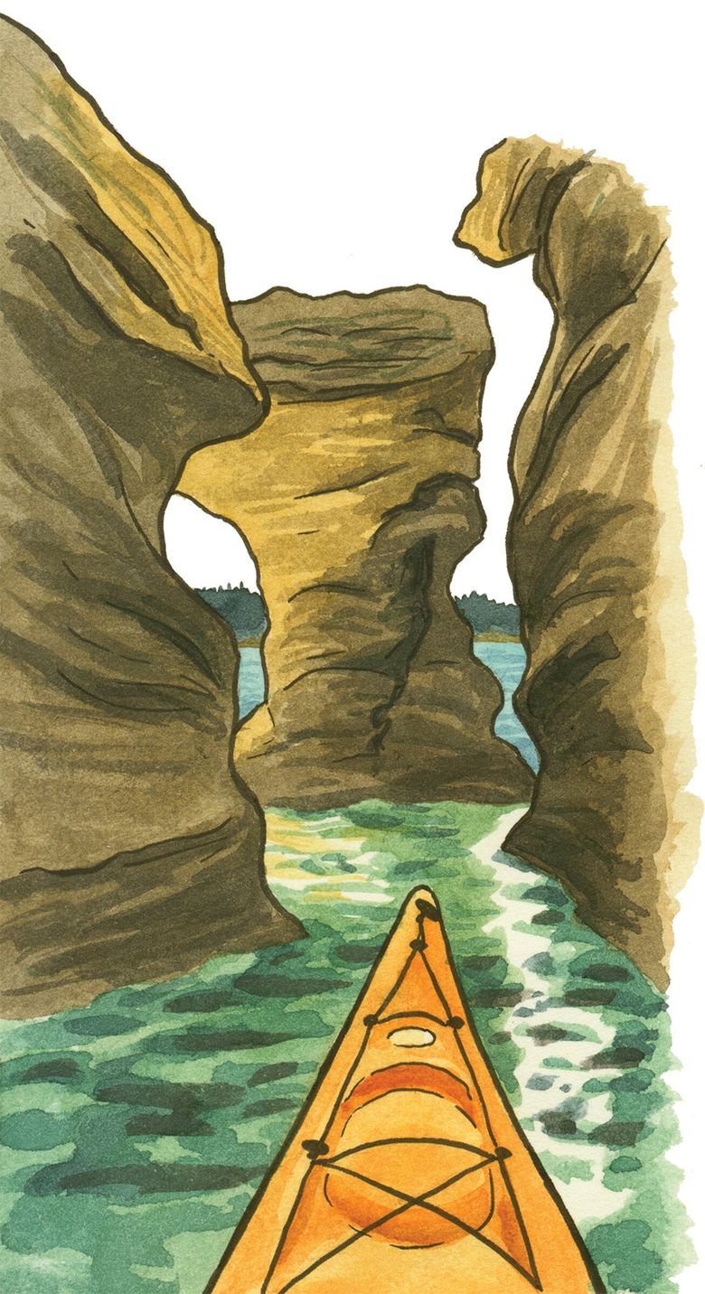
Nature’s carving tools are on display at the Malaspina Galleries, at the northwestern end of the island. This spectacular, tsunami-shaped sandstone formation was scooped out over centuries by wind and water. Make sure to visit at low tide to get the full effect, and see the honeycomb of tafoni weathering on the floor of the hollow.
Other islands
The Southern Gulf Islands also include many small nonferry islands. Most are privately owned or wildlife reserves, and thus offer no public access. However, several are public parks and worth a visit. Wallace Island Marine Provincial Park, just north of Salt Spring, is an especially lovely kayaking spot, with several sheltered coves, a picnic shelter and 18 campsites. There are hiking trails from one end of the skinny island (which until 1905 was called Narrow Island) to the other, offering great spots for wildlife viewing, including bald eagles, otters and — if you’re lucky — mink.
A floating national park
A patchwork of island parklands southeast of Salt Spring is collected into Gulf Islands National Park Reserve. The park is almost entirely backcountry, with no visitor center and few services. Boaters should take care around ferry traffic and strong tidal currents.
Prevost Island is in the thick of the ferry traffic lanes — though no routes actually stop here. Similar to Sucia Island in the San Juans, there are many bays, sheltered coves and long fingers of land. There are two park areas here, on opposite ends of the island, with a campground at James Bay and Portlock Point Lighthouse at the southern tip. Portland and Russell islands both had farms established by Kanaka (Native Hawaiian) families. Between them five heritage orchards remain, plus historic Mahoi House on Russell. Both islands also have significant Indigenous cultural sites, including a 1,000-year-old clam garden on Russell. Portland Island also doubles as Princess Margaret Marine Park — it was once owned by the princess, and she donated it back to the province in 1958. Tiny Isle-de-Lis, formerly named Rum Island, was a base for Prohibition-era rumrunners. Today there’s a backcountry campsite and great views of Turn Point Lighthouse on Stuart Island. D’Arcy and Sidney islands are more easily accessed from Sidney.
The top of the archipelago
There are also several nonferry destinations at the other end of the Southern Gulf Islands. Much of Valdes Island is private, belonging to the Lyackson First Nation reserve — a community of about 200 people, plus about 60 archaeological sites, some of which date back 5,000 years. Valdes does provide a few tourist highlights, including Wakes Cove Provincial Park, a day-use recreation space for kayakers. There’s a marine campsite at Blackberry Point, part of the Gulf Islands Marine Trail.
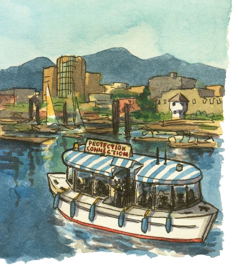
Protection Island is a bedroom community for adjacent Nanaimo, but it does have three public parks, several hiking trails and a small museum at the lighthouse. The island is also home to the Dinghy Dock, Canada’s only floating pub. Nearby Saysutshun (formerly Newcastle Island) is a marine provincial park operated (with a seasonal ferry) by the Snuneymuxw First Nation. You can book a walking tour with a Coast Salish guide, a salmon barbecue with traditional singing and storytelling, or other cultural experiences, by contacting the Snuneymuxw event coordinator.
The string of islands between Valdes and Vancouver islands is known as the De Courcy Group, including Mudge, De Courcy, Pylades and others. There’s no ferry service, though Gulf Island Seaplanes offers service to De Courcy. You’ll find two marine provincial parks here: Pirates Cove on De Courcy Island (camping available), and Whaleboat Island Marine Provincial Park (day use only).
Lasqueti & Texada
For tourists, the Northern Gulf Islands seem to begin a bit reluctantly. A privately run “foot ferry” (no cars, no BC Ferries passes!) serves Lasqueti from French Creek Harbour on Vancouver Island. Until recently, this off-grid island’s electricity came from diesel generators that switched off each night, leaving locals to rely on candlelight and lanterns. Today, much of the island has converted to solar power — as well as other green infrastructure such as composting toilets — making Lasqueti a local pioneer in renewable energy and sustainable living. The tourist activities here are equally quiet and off-grid. Many come for the kayaking — especially at Squitty Bay Provincial Park and, just offshore, Sabine Channel and Jedediah Island Marine Provincial Parks.
Texada Island, on the other hand, is technically considered part of the Sunshine Coast. BC Ferries offers service from Powell River — though at times it also has expanded service to Comox on Vancouver Island in a triangle run. Texada’s tourist draws are definitely in the “roughing it” category. The island’s lakes, trails and provincial parks are remote, often requiring a high-clearance, four-wheel-drive vehicle to reach by land. Shingle Beach is popular with paddlers — waterfront camping is available here, as well as at Shelter Point Regional Park. Remote as the island is, however, you won’t need to worry about becoming lunch yourself. Texada advertises itself as one of the few BC islands with no large carnivorous wildlife.
Denman and Hornby
BC Ferries runs the world’s longest cable ferry — a boat crossing back and forth on a tether — to Denman Island from Buckley Bay. Fillongley Provincial Park was an early-20th-century private estate, whose former bowling green is now a wildflower meadow ringed by imported deciduous trees. Ten campsites flank the beach (reservations highly recommended). At the southern tip of the island is Boyle Point Provincial Park, with views of Chrome Island Lighthouse, just offshore.
Continue on from Denman with another ferry to Hornby Island (note that Hornby’s ferry does not connect directly to Vancouver Island, but you can purchase your “thru fare” to Hornby when you buy your Denman ticket). You’ll find a few camping options here, including “glamping” tents at the Fossil Beach Farm cidery. Helliwell Provincial Park, at the island’s eastern tip, protects an old-growth forest of Douglas fir and Garry oak trees. And Tribune Bay Provincial Park is home to what might be the best swimming beach on the Salish Sea. The bay’s southern exposure keeps its shallow waters warm. The white sand, balmy microclimate and vivid aquamarine waters have led locals to call the beach “Little Hawaii.”
The Discovery Islands
Occupying the area between Desolation Sound and Johnstone Strait, the Discovery Islands mark the northern boundary of the Salish Sea. These are considered Northern Gulf Islands by some, though not all. BC Ferries serves Quadra and Cortes, flights and water taxis reach the outer islands, and Desolation Sound is best accessed from the Sunshine Coast. Protected coves and 360-degree scenic views make this a boating paradise. (Paddlers beware: There are so many islands and waterways here that navigation can be tricky.) Johnstone Strait, especially, is a favorite of whalewatchers and marine scientists. In the summer, a population of about 150 orcas — including both transients and the northern residents — feeds along the passage.
Preserving the Potlatch
A short ferry from Campbell River runs to Quadra Island, landing at Quathiaski Cove, home of the island’s few services. The north end includes Main Lake Provincial Park (a wilderness camping spot), Octopus Islands Marine Provincial Park (popular with boaters) and Small Inlet Marine Provincial Park (home to tidal rapids). Halfway down Quadra’s eastern shore is Rebecca Spit Marine Provincial Park — great for a long beach walk or a windsurfing adventure. At the southern tip of the island is Cape Mudge Lighthouse, built in 1916. Cape Mudge Village is the seat of the We Wai Kai First Nation, a band of Kwakwaka’wakw people. Make sure to visit the Nuyumbalees Cultural Centre, home of seven of the island’s many ancient petroglyphs — as well as the Kikasuw (Sacred Potlatch Collection), a group of Kwakwaka’wakw ceremonial objects repatriated back from white-owned museums decades after federal authorities confiscated them under anti-potlatch laws.
Beyond the ferry
The Discovery Islands also have many large and small outer islands. There are no cities and few permanent residents out here, but plenty of outdoor recreation spots. Fish the waters of Rendezvous Island South Provincial Park, view wildflower blooms on Mitlenatch, kayak around East Thurlow or watch the Shark Spit Regatta sail around Marina Island. If you can’t decide, take a guided “island-tasting” tour — Misty Isle Adventures runs sailing day trips, and Coast Mountain Expeditions offers multiday kayak camping trips.